Roadtrip around the weather, not into it
Define the weather you like and find places to stay along your route.
The problem
Say you're a broke college kid in Chicago, and you're driving to Austin City Limits with a tent in the trunk. That's roughly twenty hours of road through five states — and somewhere between your driveway and the festival gates is a forecast that matters a lot when your bedroom has a zipper: a surprise night of 40 mph gusts in Oklahoma, a monsoon cell parked over your Ozarks campsite, or a storm system you drive straight into because you only checked the weather for a single destination rather than the whole route.
Today, avoiding this form of abject misery that so many roadtrippers know so well means searching town after town, constantly checking a radar map a dozen times while zooming in to the max for your specific spot, cross-referencing ten-day charts that change every day, and more — for every night of the trip. It's tedious, and it sucks.
The solution
Fairweather fixes this comprehensively. One query: Chicago to Austin, six days, your weather preferences. Out comes a list of stops that will ideally be pleasant — with drive times, per-night forecasts, etc — and if there are forecasted problems, they are flagged well in advance so you can plan around or accordingly.
What's inside Fairweather
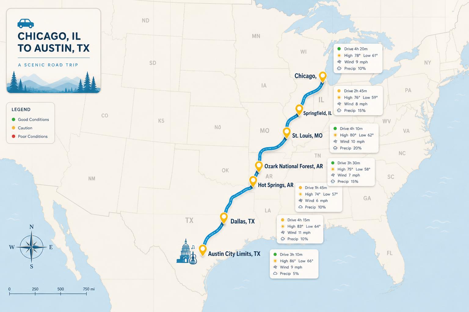
Roadtrips planned around the sky
Give Fairweather a start, a destination, and a time budget. It finds stops along the route whose forecast matches your preferences, shows you night-by-night which days are fair and which turn, and totals up the drive time. Auto-plan the fairest itinerary, or build your own stop by stop — and riff on any stop to scan nearby alternatives.
A forecast that passes judgment
Most apps hand you a chart and leave the interpretation to you. Fairweather knows your comfort ranges — temperature, wind, precipitation — and marks every day by them, so you can see at a glance whether the weather works for you.
Find Better Weather
Bad weather where you are doesn't have to mean a bad day. Tell Fairweather where you're starting from and it scans the area for places whose forecast fits your preferences, ranked by distance, so “should I drive somewhere?” becomes a list, not a guess.
Your places, on a map
When you've got time and gas in the tank, where is more important than when. Save your favorite spots and keep an eye on them for your next return trip.
Plan around the weather, not into it
Set your comfort ranges once, then let Fairweather find the fair-weather stops for you.
Forecast data by Open-Meteo, which blends gridded weather models (NOAA, DWD, Météo-France and others) rather than a single physical weather station — values reflect the model grid point and elevation nearest your location.